MARITIME SAFETY COOPERATION
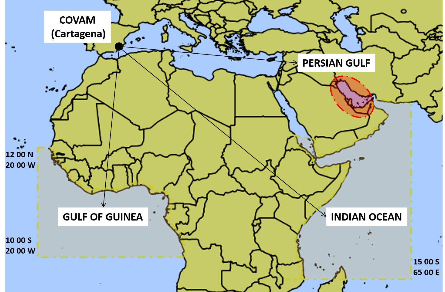
The Spanish Navy is currently managing three areas of cooperation with shipping: (1) Gulf of Guinea (12ºN-10ºS/ 020ºW-shoreline), (2) Indian Ocean (15ºS-065ºE-shoreline) and (3) Central Mediterranean.
These areas have been established to improve the security of those ships saling through their waters under Spanish Flag (or being of Spanish National Interest), given the threat posed by the presence of pirate action groups, and to de-conflict with existing military operations to counter illegal traffic of migrants.
The Spanish Navy considers to be linked to Spanish national interests all those ships that, even not flying the Spanish Flag, are property of a Spanish citizen or enterprise, or include Spanish citizens within their crew.
HOW MAY I JOIN THE SPANISH NAVY'S COOPERATION SYSTEMS ESTABLISHED IN THERE AREAS?
If you wish to benefit from the security information provided by the Spanish Navy Maritime Surveillance and Operations Centre (COVAM) regarding these areas of cooperation, you must register with us the transit of your ship, by filling-in a simple Format ALFA form.
MS EXCEL FORM DOWNLOAD: Format ALFA in Excel format
Once filled-in, it must be send to the following e-mail address spfamcovam@fn.mde.es.ATENTTION: Format ALFA has a number of compulsory items, clearly marked with an asterisk (*). Please, be aware these are required data; if omitted, your ship's transit cannot be registered, and you will not be provided with any information or support.
MUST I UPDATE THE POSITION OF MY SHIP DURING HER TRANSIT THROUGH THE COOPERATION AREAS?
Once your ship's Format ALFA is received, the COVAM will monitor her transit by using different means (AIS, AIS-SAT, LRIT, etc.). However, it is recommended to update the ship´s position information by sending a Format BRAVO every 24 hours along the whole duration of the transit.
For that purpose you must send.

